Site Evaluation, Soil, and Permits: The Complete Guide
Last updated: September 10, 2026
Key Takeaways
- A 2% slope behaves very differently from a 15% slope, and a dry site in August can still be saturated in March.
- A 100-foot lot line can mean very little if part of it is a drainage easement and another strip is inside a front setback.
- A clean paper file saves hours because the first 30 minutes of any review usually go to questions that the documents can answer.
- A useful site review usually produces a yes, a no, or a yes-with-conditions.
Planning a house? An addition? A garage, barn, driveway, septic system, or retaining wall? Then the first question is blunt: can this site legally and physically handle it? Start with site evaluation, soil review, and permits before you sketch pretty plans or order materials. Those three decide whether the project can happen at all. For site evaluation, soil, and permits: complete guide, the first step is to ask what the land can actually support.
Who this is for — and who should do something else

This guide is for a property owner, buyer, builder, or project manager who needs to figure out whether a site is buildable and what approvals come before work starts. It assumes you already know the rough idea of the project — for example, “a 24-by-32 garage,” “a 1,200-square-foot addition,” or “a new septic field” — but you do not yet know the land’s constraints, the soil’s limits, or which permits the local authority will ask for. It also assumes you can read a survey, understand a basic site plan, and gather documents from a county office, zoning desk, or environmental health department.
Paperwork alone won’t carry this. Site evaluation is the process of checking access, slope, drainage, setbacks, easements, flood risk, utility locations, and other conditions that affect where and how something can be built. Soil evaluation is the part that tells you whether the ground can support foundations, pavement, infiltration, septic drainage, or slope stability. Permits are the legal approvals that keep the work from being stopped after excavation starts.
I would not treat this as a do-it-yourself job if the project touches a septic system, a steep slope, a retaining wall over about 4 feet, a wetland, a floodplain, a shared driveway dispute, a boundary line question, or a foundation on questionable fill; consult a qualified professional before you commit to a design. The USDA Natural Resources Conservation Service, FEMA, and many local health departments all point to site-specific review for these conditions. A reader can often do the early homework alone, but once the site has drainage problems, unstable soil, or zoning ambiguity, guessing becomes costly fast. Blind guessing turns into a money pit.
The right mindset is not “How do I get a permit?” It is “What does this site allow, and what proof will the reviewer need?” That shift alone keeps a lot of projects from stalling for 6 months because somebody assumed the land would cooperate.
What is actually being checked on a site?
Site evaluation answers five practical questions: where can the project fit, what can the ground hold, where does water go, what rules apply, and what evidence will the permit office want to see? Those questions sound simple, but each one hides a different layer of review in site evaluation, soil, and permits.
Start with the physical side. Property lines, building setbacks, topography, drainage paths, existing structures, well and septic locations, overhead lines, buried utilities, and access for people and equipment all matter. A site that looks large from the road may still be tight once you account for easements and required clearances. A 100-foot lot line can mean very little if 35 feet of it is a drainage easement and another strip is inside a front setback.
Soil is where generic advice goes sideways. Not every “soil test” means the same thing. A geotechnical investigation for a foundation looks at bearing capacity, settlement, groundwater, fill, and slope behavior. A perc test or soil evaluation for a septic drain field looks at infiltration and seasonal saturation. A landscaping estimate may only need a rough feel for topsoil depth and compaction. Mix those up, and you can end up with a foundation that settles, a driveway that pumps mud, or a septic system that never passes review. For practical guidance, the USDA NRCS and local health departments distinguish between soil mapping, site evaluation, and percolation testing.
Permits are not one permit. Many projects need a chain: zoning clearance, site plan approval, erosion control sign-off, building permit, septic permit, driveway permit, stormwater approval, tree removal permit, floodplain review, and sometimes utility or fire marshal review. The order matters. File the building permit before zoning is settled, and the application may sit untouched while the reviewer sends it back for missing prerequisites. Slippery slope.
A useful site review usually produces a yes, a no, or a yes-with-conditions. “Yes” means the project fits the site as drawn. “No” means the site or rules block the idea in its current form. “Yes-with-conditions” is the most common answer: smaller footprint, different location, retaining wall, engineered drainage, soil replacement, or a revised septic layout.
What should you gather before you call anyone?

You should gather the survey, deed, tax parcel map, prior permits, utility records, and any known soil or septic documents before anyone visits the site. A clean paper file saves hours because the first 30 minutes of any review usually go to questions that the documents can answer.
Begin with a current boundary survey if one exists. Look for property lines, easements, rights-of-way, setback lines, benchmark elevations, and any existing improvement locations. If the only map you have is a tax assessor sketch, treat it as orientation only, not as a construction document. Tax maps are helpful for parcel numbers and general shape, but they are not precise enough to stake a building corner or resolve a boundary dispute.
Then collect the deed and any recorded restrictions. Deed restrictions, conservation easements, and subdivision covenants can be stricter than the zoning code. A lot can be legally zoned for one thing and privately restricted from doing it. That is one of the most common surprises in rural and subdivision projects.
Next, find out what utilities are present and where. A utility locate from 811 tells you where public underground lines are marked before digging, but it does not map private lines on your property with certainty. Septic tank records, well logs, and old site plans may show abandoned systems, drain fields, or service laterals that do not appear on a current aerial photo. Since buried lines and underground utilities can shift the project layout, confirm them before you finalize the plan.
For soil and drainage, check county soil maps, USDA NRCS soil survey data, flood maps from FEMA, and any prior geotechnical or perc reports. These are not replacements for field work, but they help you see likely problem areas. If the parcel sits on mapped hydric soils, a floodplain, or a steep colluvial slope, I would expect extra review rather than hoping the issue will disappear during permitting.
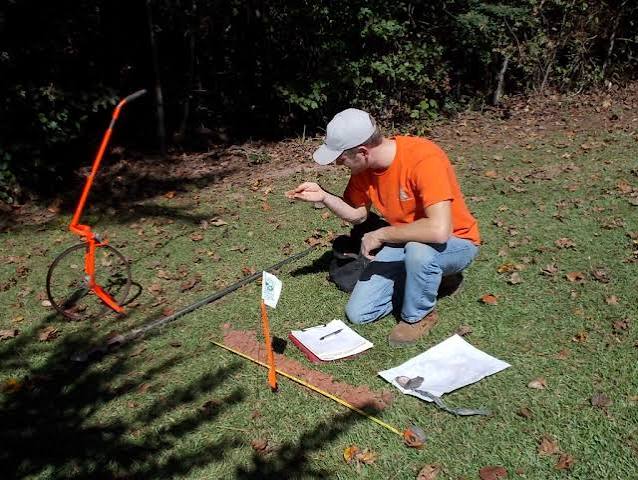
I would also write down three site facts before any consultation: approximate slope, visible water movement after rain, and the nearest distance between the project area and any well, septic tank, stream, ditch, or lot line. Those details shape the entire path. A 2% slope behaves very differently from a 15% slope, and a dry site in August can still be saturated in March.
How do site evaluation, soil review, and permits work together?
They work in sequence, and the sequence matters because each step narrows the next one. The common mistake is trying to design first and ask questions later. That creates plans that have to be redrawn after a reviewer points out the setback, soil, drainage, or access problem.
- Confirm the project type and the approval path. Write the project in one sentence, such as “a detached 24-by-32 garage on slab” or “a replacement septic field for a three-bedroom house.” Check whether the local authority treats it as zoning-only, building, land disturbance, septic, driveway, or environmental review. If you cannot name the permit path, that is a problem because you may be designing to the wrong rule set.
- Obtain a current boundary survey or reliable base map. Use a survey that shows lot lines, easements, existing structures, and if possible topography at 1- or 2-foot contour intervals. Check the date, the surveyor’s stamp, and that the parcel matches the deed description. If the survey is outdated or missing improvements, the project location may be wrong by several feet.
- Measure the buildable envelope. Mark setbacks from front, side, rear, stream, wetland, septic, and well locations according to the local code, which may be 5, 10, 15, 25, 50, or more feet depending on the feature. Check the remaining rectangle or irregular footprint that is still legal. If the envelope is too small for the project, the problem is not the design software; it is the site.
- Read the land for slope, drainage, and low points. Walk the site after rain if possible, or look for erosion lines, mossy depressions, soft spots, and outlets where water exits the parcel. Check whether runoff moves toward the proposed work area or away from it. If water crosses the area, expect grading, swales, underdrains, or a different location.
- Determine the soil type and the likely test required. For a foundation, ask whether a geotechnical report is needed; for septic, ask for a soil evaluation or perc test; for paving or embankments, ask whether compaction and subgrade testing are required. Check whether the soil is native, imported fill, organics, clay, silt, sand, or bedrock. A problem is any note about uncontrolled fill, high groundwater, organics, or refusal at shallow depth.
- Check groundwater, floodplain, and seasonal saturation constraints. Compare the site against FEMA flood maps and local wetland or drainage overlays, and note any groundwater encountered in test pits or augers. Check whether the highest seasonal water table will conflict with foundation depth or septic trench depth. If groundwater is near grade, standard assumptions about dry excavation will fail.
- Map access and construction logistics. Measure the route for equipment, trucks, and material deliveries, including width, turning radius, overhead clearance, and soft ground. Check that a concrete truck, excavator, or septic tank delivery can actually reach the work area without crossing a neighbor’s land. If access is tight, the project may need smaller equipment, temporary mats, or a different entry point.
- Pre-screen the permit list before design is finalized. Call or check the local department for zoning, building, stormwater, septic, driveway, and erosion control requirements, and ask which drawings or forms they want first. Check submission order, scale requirements, and whether wet seals from licensed professionals are required. If the office says “bring a site plan first,” do not assume the building permit package will be enough.
This is the stage where a lot of projects succeed or fail quietly. If the project fits on paper after setbacks, slopes, and soil are known, the permit process becomes a documentation exercise. If it does not fit, the sooner you learn that, the cheaper it is. A revised concept drawn before permit submission is annoying. A revised concept after excavation is expensive. The bill can jump fast.
Which soil problems matter most?
The soil problems that matter most are bearing, drainage, compaction, groundwater, and shrink-swell behavior, because those five things decide whether the site stays stable after construction. “Soil” is not one substance. A sandy lot, a clay lot, and a lot underlain by fill all behave differently even if they are in the same subdivision.
For foundations, bearing capacity is the soil’s ability to support load without excessive settlement. Settlement is the downward movement of the structure over time. A typical design might rely on undisturbed native soil, but if the builder is actually sitting on loose fill, organic topsoil, or a buried trench, the foundation can move unevenly. That movement shows up as cracks, sticking doors, sloped floors, and misaligned trim.
For drainage and septic, permeability and seasonal saturation matter more than simple dryness on the day of the inspection. A soil that drains quickly at the surface may still have a restrictive layer below. A clay layer a few feet down can perch water above it after storms. That is why a site that looks “fine” in midsummer can fail a winter or spring review. The EPA notes that wastewater and stormwater design both depend on how water moves through the profile.
Compaction is another detail people underrate. Imported fill placed in lifts and compacted to a known standard performs very differently from dumped fill pushed around with a bucket. If someone says “we filled it years ago,” I would not treat that as structural fill. The difference between random fill and engineered fill can determine whether a slab cracks or stays level. In many jurisdictions, fill under a structure needs proof of placement and compaction, often from a geotechnical report or field density testing.
Shrink-swell soils, often clays with high plasticity, can expand when wet and shrink when dry. That seasonal movement can crack slabs, separate masonry, and push on foundations or pavements. Expansive behavior is one of the reasons local building departments sometimes require deeper footings, moisture control, or special foundation design.
For septic work, the soil evaluation is often the key gate. A perc test or soil profile evaluation tells the reviewer whether effluent can disperse safely. A failing result does not always mean “no septic possible,” but it often means a larger drain field, a different design, mound treatment, or another wastewater solution. If the site is wet, shallow to bedrock, or underlain by heavy clay, the standard trench approach may not work.
I would be cautious about any site where soil clues are mixed: soft at the surface, hard underneath, wet in spring, dry in summer, or heavily disturbed by past grading. Those are the sites where “it looked okay from the truck” becomes a costly sentence.
What permits do you actually need?
You need the permits that match the work, not the permits that sound familiar. The list often includes zoning approval, building permit, land disturbance or erosion control approval, septic permit, driveway permit, stormwater review, floodplain development permit, and sometimes wetland or tree removal approval. Some jurisdictions bundle these; others make you visit three or four offices.
Zoning usually answers whether the use is allowed and whether the structure fits setbacks, height limits, lot coverage, and accessory-use rules. Building permits address structural code compliance, such as footings, framing, fire separation, and life-safety details. Septic permits deal with wastewater disposal, not building structure. Driveway permits concern access to public roads and sight distance. Stormwater review addresses runoff, infiltration, and detention.
If your project disturbs soil, the permit office may ask for an erosion and sediment control plan even for a modest site. That plan can be as simple as silt fence, stabilized construction entrance, and temporary seeding, or it can be far more detailed on larger sites. A generic drawing pulled from the internet often fails because it does not match the actual slope, drainage path, or soil exposure.
The most efficient order is usually: verify zoning first, then soil feasibility, then complete the site plan, then file the permit package. The reason is basic. There is no point fine-tuning a foundation or septic layout before you know the project is legal in that location. A revised plan set after zoning review is normal. A project that ignores a denied use is wasted effort.
The detail that gets missed most often is signatures and seals. Some localities accept owner-prepared sketches for simple work. Others require a licensed surveyor, engineer, or designer to prepare the drawing. Septic designs and structural plans often need professional stamping. That is not bureaucracy for its own sake; it is how the reviewer knows the design was prepared by someone accountable to a professional standard.
A permit file that is complete usually includes a site plan at the required scale, setbacks, dimensions, topography where needed, existing and proposed grading, drainage arrows, utility locations, and any supporting soil or engineering reports. If the application asks for a 1-inch = 20-foot site plan and you submit a rough sketch at no scale, expect a rejection or a long delay.
When should you stop and bring in qualified help?
Stop and bring in qualified help when the site conditions mean a standard plan may be unsafe, noncompliant, or likely to fail. That is the right move because the cost of getting soil, drainage, or permit assumptions wrong is usually measured in redesign, excavation, and delay, not just paperwork.
Septic absorption areas are involved: wastewater disposal rules are technical, and a failed layout can make a house unbuildable — hire a licensed septic designer or the local equivalent before you commit to a footprint.
The project is within a floodplain, wetland buffer, or stream setback: the land-use rules can change by jurisdiction and may trigger separate approvals — stop and ask the floodplain or environmental office what can be built and where.
The site has fill, old demolition debris, or an unknown imported soil layer: the ground may not have predictable bearing or drainage — get geotechnical input before you design footings or slabs.
The slope is steep enough that you are considering retaining walls, cut-and-fill, or terracing: grading can create stability and drainage problems — hire an engineer if the wall is above the local unengineered threshold, often around 4 feet, or if the slope is carrying water.
The boundary is uncertain or the setback line is close to the proposed work: a few feet can decide whether the project is legal — use a licensed surveyor before you place corners, piers, or a driveway.
You need to connect to a public road or cross a drainage ditch: access approvals can involve sight-distance, culvert sizing, or road-opening rules — coordinate with the road authority before starting excavation.
The permitting office asks for sealed drawings, stormwater calculations, or engineered grading: that is the office telling you the project is beyond a sketch-level submittal — do not try to bluff through with a hand-drawn plan.
Ignoring those situations does more than annoy a reviewer. It can trigger a failed permit, a stop-work order, a redesign after materials are ordered, or a structure that cannot be signed